Upper atmosphere gridlock stalled Dorian

Hurricane Dorian is finally moving. But for a day-and-half it just sat on and pounded Grand Bahama Island because nothing high up in the atmosphere was making it budge.
That meteorological gridlock, which slows or stalls storms, is happening more often in a warming world, studies show.
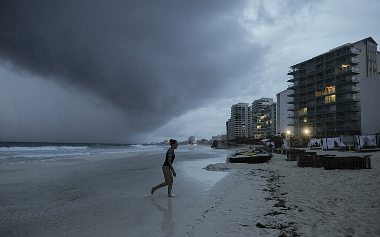
Before Dorian picked up speed Tuesday morning, the upper atmosphere had been too calm. While this had been horrible for the Bahamas, where the storm's onslaught had been relentless, meteorologists said it may have helped spare Florida a bit.
Usually the upper atmosphere's winds push and pull Atlantic hurricanes north or west or at least somewhere. They are so powerful that they dictate where these big storms go.
But the steering currents at an altitude of 18,000 feet (5,486 meters) had just ground to a halt. They were not moving, so neither was Dorian.
After reaching record-tying wind speeds on landfall in the Bahamas, the storm stalled. Its eyewall first hit Grand Bahama Island Sunday night, and into Tuesday morning part of the eye still lingered there, meteorologists said. For 28 hours on Monday and Tuesday, the hurricane center said the storm was either stationary or crawling at 1 mph (1.6 kph).
"This is unprecedented," said Jeff Masters, meteorology director at Weather Underground who used to fly into hurricanes. "We've never had a Category 5 stall for so long in the Atlantic hurricane record."
For all storms, regardless of size, "it's very odd" but not quite unprecedented, said National Oceanic and Atmospheric Administration climate scientist Jim Kossin, who has studied the forward movement of hurricanes. Tropical cyclones around the world are slowing down, he said.
In Dorian's case, there is an ongoing battle between high pressure systems that push storms and low pressure systems that pull them.
A high pressure system in Bermuda has been acting like a wall, keeping Dorian from heading north. But a low pressure trough moving east from the Midwest has eroded that high and is trying to pull Dorian north. Those two weather systems "are fighting it out and neither is winning," Masters said Monday.
There's just no flow pushing it anywhere. Think of it like a tiny paper boat or a pebble in a stagnant pond, which just doesn't move, said Colorado State University hurricane researcher Phil Klotzbach.
Finally, Tuesday morning the low pressure trough eroded enough of the high pressure system to allow Dorian to start moving northwest. It was forecast to move more northward after that and eventually pick up speed.
What happened to Dorian "is consistent with the kind of changes that we might expect with global warming," NOAA's Kossin said Tuesday. He said this storm has not been studied in the precise ways that climate scientists need to say global warming was a factor.
But Kossin's 2018 study in the journal Nature found tropical cyclones around the globe had slowed down 10% from 1949 to 2016. And he was able to examine U.S. storms back to 1900 and found a 17% slowdown since then.
"I find it very compelling that we're observing that much of a slowdown over a long period of time," Kossin said.
It all starts in the Arctic, which is warming faster than the rest of the globe because of emissions of heat-trapping gases from the burning of coal, oil and gas. The jet stream, which moves global weather along, slows down when there's less of a temperature and air pressure difference between the Arctic and lower latitudes, Kossin said.
This theory linking Arctic changes to the slowing jet stream is not completely embraced by mainstream climate scientists, but there has been a growing acceptance of it in scientific literature.
In 2017, Hurricane Harvey got stuck when the upper atmosphere's steering currents collapsed, drenching and flooding Houston, but that wasn't as powerful a storm as Dorian, Klotzbach said.
Usually hurricanes that don't move eventually kill themselves because they churn up colder water from deep below the ocean's surface and are deprived of the warm water that fuels storms, Masters said.
"It's got to keep moving," he said.
By Tuesday morning, Dorian was down to 110 mph, still potent and dangerous Category 2, but no longer a major hurricane.
___
Follow Seth Borenstein on Twitter: @borenbears
___
The Associated Press Health and Science Department receives support from the Howard Hughes Medical Institute's Department of Science Education. The AP is solely responsible for all content.